September 14, 2005
cell phone landscape.
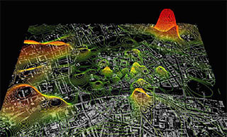
this project from MIT's SENSEable City Laboratory maps a city's cell phone density in real time, by "pinging" the phones anonymously for location.
This topography is overlaid against satellite imagery, cell tower locations/links (i think), and elevation topography.
more images [pdf]
Posted by jb at September 14, 2005 11:48 AMComments